Northern Basin and Range
...ecoregion is sparsely inhabited, but the local communities have vibrant cultural traditions. The largest community is Ontario, with more than...
...ecoregion is sparsely inhabited, but the local communities have vibrant cultural traditions. The largest community is Ontario, with more than...
...Pacific Coast Salmon Recovery Fund), Meyer Memorial Trust, Bonneville Environmental Foundation, and others completed an extensive restoration project to increase...
This COA includes much of Steens Mountain’s southwestern flank before moving north and skirting along the edge of Malheur National...
...and the Government Island complex located between River Mile 111 and 119. The complex includes Lemon and McGuire Islands and...
Area includes the Tualatin River and floodplain, numerous tributaries, and associated uplands from the confluence with the Willamette River upstream...
Area extends from the Willamette River area upstream to Estacada and includes floodplain, tributaries, and upland habitats.
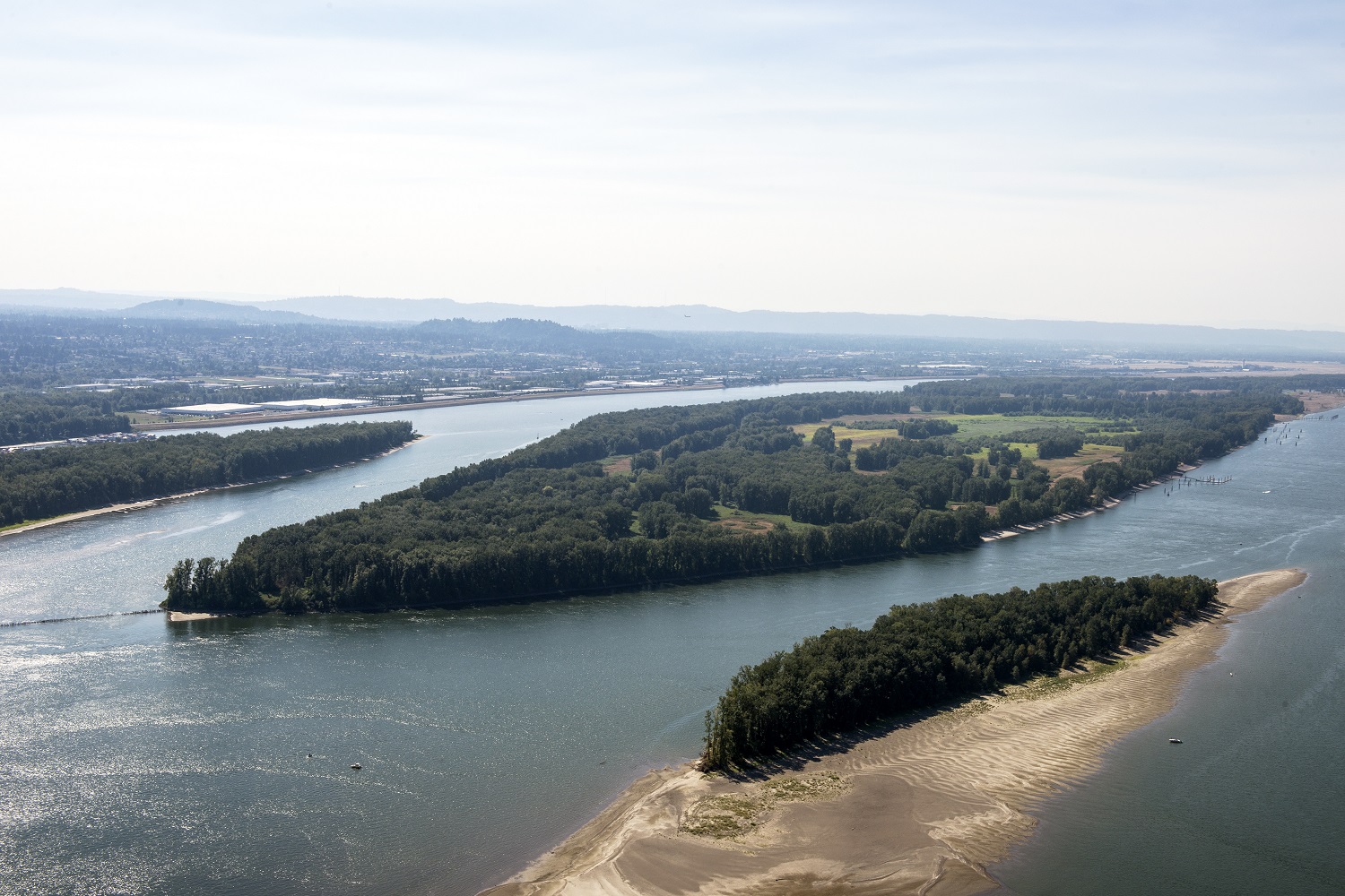
A large (3,000+ acres) island located at River Mile 78-81 along the Lower Columbia River.
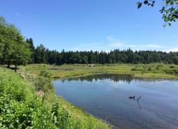
Also known as Killin Wetlands and Cedar Canyon Marsh, this 590-acre Metro-owned site is located west of Banks in the...
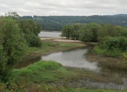
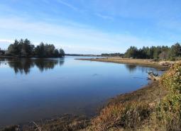
This area is located north of Portland and is comprised of Sauvie Island, Multnomah Channel, the Scappoose Bay area and...
Smith-Bybee Lakes is located north of Portland, adjacent to the confluence of the Willamette and Columbia Rivers. The Columbia Slough...
...Salmon Recovery Fund), Meyer Memorial Trust, Bonneville Environmental Foundation, and others completed an extensive restoration project to increase the amount...
Area is also known as the Red Hills Conservation Area. Includes the Red Hills of Dundee, which separate the Chehalem...

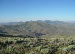
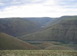
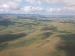
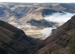
Spanning an area in the southeastern corner Harney County and southwestern Malheur County, this COA encompasses the Trout Creek Mountains,...
Area is located west of Salem and includes tributaries of the South Yamhill River, Willamette River, and Rickreall Creek.
Mainly located on the Warms Springs Reservation, this narrow COA includes a section of the Deschutes River from above the...
...north east, the COA crosses into Malheur County and wraps around Swamp Creek Buttes. Continuing north towards Juntura, it then...
Area includes the headwaters of the Sandy River and its tributaries including the Bull Run River. Much of area is...
South of the Columbia River, in north central Oregon. Area includes important conservation lands near the Boardman Conservation Area; Willow...
Located north of Dallas along Highways 22 and 99W. Upland oak-dominated hills, Basket Slough, Ash Swale, and headwaters of Salt...
The northern boundary of this COA follows Buck Hollow Creek, with the remaining boundaries connecting to the Lower Deschutes River...
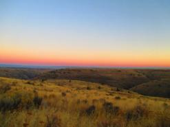
Area located east of Lakeview along the eastern border of the ecoregion
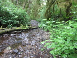
The area includes much of the Necanicum River. The watershed provides critical habitat for many coastal plant and animal communities....
This is the largest COA within the Columbia Plateau Ecoregion extending from Rock Creek to Butter Creek, totaling 809 square...
Necanicum is designated as a conservation estuary. The City of Seaside and the North Coast Land Conservancy have acquired a...
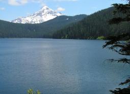
Area is adjacent to Mount Jefferson Wilderness and includes headwaters of Clackamas, North Santiam and Deschutes Rivers.
Area is located within Mount Hood National Forest and includes the headwater streams of Hood, Clackamas, Sandy and White Rivers.
Area comprised of Molalla River from Mulino upstream to the Dickie Prairie area, plus the lower reaches of major tributary...
Area is located between Scotts Mills and Molalla in the Rock Creek subbasin, a tributary of the Pudding River.
This long narrow COA spans two ecoregions. Within the East Cascades, it begins on the south side of the Metolius...
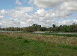
This area is comprised of the 1,500-acre Sandy River Delta at the confluence of the Sandy and Columbia Rivers, plus...
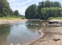
Area follows the lower John Day River and surrounding habitats.
...trout, coastal cutthroat trout, coho and fall Chinook salmon and summer and winter steelhead are found in the COA. Specifically,...
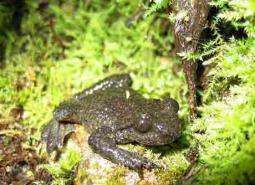
Ascaphus truei
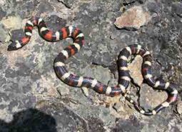
Lampropeltis zonata
Download the Oregon Conservation Strategy Front Matter (Cover, Recommended Citation, Table of Contents) (December 30, 2016) Chapter 1: Overview (April…
…to define their own conservation role. See the Strategy Overview section for more information on Strategy components, Strategy background, how…
…Council: Executive Committee and Scientific and Technical Advisory Committee David Allen, Jack Barth, Veronica Dujon, Gabriella Goldfarb, Elise Granek, Selina…
…the Strategy Overview section for more information on Strategy components, Strategy background, how the Strategy is used, and much more….
…An Amphipod (no common name)Stygobromus saltuarisWC Invertebrate An Amphipod (no common name)Stygobromus wahkeenensisWC InvertebrateBarren JugaJuga hemphilli hemphilliWCWV Invertebrate A Beetle…
…your wildlife sightings to national community (citizen) science efforts like eBird and iNaturalist. Communities Science opportunities abound, here is a…
…Data Gap Species. The Strategy Species and Data Gap Species lists are available for download in Excel table format: Download…
…COA profile information is available for download in an Excel table format: Download the Oregon Conservation Strategy. Wilderness Areas During…
…and reversing declines in these resources where possible. Strategy Components Key Conservation Issues are landscape-scale threats that impact species and…
…were compared to historical vegetation maps from 1850 to indicate vegetation types experiencing high degrees of loss since European settlement…
…simple, easily communicated, and relevant to people’s concerns. Data and information derived from monitoring should be easily understood, well-documented, and…